
REVIEW · MONTEREY, CARMEL & 17-MILE DRIVE
Smartphone Audio Driving Tour between San Francisco & Monterey
Audio beats traffic noise on this coast.
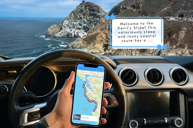
This smartphone audio driving tour turns the San Francisco to Monterey road into a guided story, with stops that range from steep coastal lore to tide pools, lighthouses, and classic beach towns. You get English narration while you drive, and you can go at your own pace with a route that strings together real places along the way.
I especially like two things: the easy, simple use of the app format and the fact that the narration is specific to the places you pass, like Montara State Beach, Moss Beach tide pools, and the 1875 lighthouse. At a cost of $11.99 per group (up to 15) for a private vehicle tour, the value is hard to beat if you have even a small carpool.
One possible drawback: this is not a stop-and-get-out-and-wander tour every few minutes. The experience leans toward driving continuously with audio, with pull-offs mainly for scenic breaks, so if you want lots of designated sightseeing stops, you may feel a little rushed unless you plan your own pauses.
Key points worth your attention
- Narration runs with your drive across cliff roads and coastal towns, so you do not need to constantly check maps.
- You only need a download up front, then you can continue with no signal and no data used during the tour.
- Low price per group, private by vehicle, which makes it especially good for small families or friend groups.
- A lot of variety in one stretch: beaches, tide pools, lighthouses, salt marsh habitat, and coastal national storytelling.
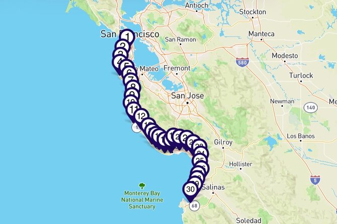
- Direction flexibility: start in San Francisco or Monterey, and the experience is the same either way.
- The early route is optional if you want to get rolling fast and let the audio catch up while you drive.
Why smartphone audio is such a smart way to do SF to Monterey
On the SF to Monterey coast, the road itself is part of the show. High points give you wide views. Headlands can feel dramatic and close at the same time. And in between, you pass lots of small towns where it is easy to miss the story if you are just driving by with no context.
This tour fits that reality. You are not trying to pack in hikes and timed tickets. Instead, the audio guide gives you a running explanation as you cruise. It is like having a friend riding shotgun who knows where the cliffs came from, why certain areas matter, and what you should notice when you look out the window.
A big practical win is how the app handles connectivity. You do need a good mobile or WiFi connection for the initial download, but after that, no signal is required and no data is used during the tour. That matters on the coast, where reception can be spotty.
And since only 1 tour booking is needed per vehicle, you can split the cost. At $11.99 per group up to 15, it can work out to lunch money, not guided-tour money, as long as your group is already planning the drive.
The coastal road feel, from steep starts to salt marsh lessons
Even before you get to specific named stops, the route sets expectations. You start near San Francisco and work your way along coastal stretches that include a notoriously steep and rocky route tied to Ocean Shore Railroad plans from the past. That theme continues with other story anchors: outdoor beaches, protected tide pool areas rich with marine life, and an 1875 lighthouse that has guided mariners for generations.
Later, the tour shifts from cliff and shoreline sights to habitat and geology. You will hear about protected coastal areas, marsh habitat for migratory and native species, and even underwater geography, with a mention of an underwater chasm compared to the Grand Canyon. By the time you reach the Monterey area, it is not just scenery, it is why the coastline looks the way it does.
One more thing that helps: the tour is no time constraints. You do not have to chase a strict schedule. If you want to linger near a beach turnout or take a slow look at a viewpoint, you can.
San Francisco to Montara and Moss Beach: tide pools and the ocean getting dramatic
This part of the drive is where you build momentum, and the audio gives you a sense of place fast.
You begin with San Francisco as it is colloquially known, setting the stage for cultural diversity and technological innovation, then you move into the story of a steep coastal route tied to Ocean Shore Railroad ambitions that go back to the late 1800s. The payoff here is not that you learn names of companies. It is that you understand why this coastline has such a rugged, engineered feel in certain stretches.
Next comes Montara State Beach, where the narration points you toward the cliffs dropping into the Pacific. If you like looking for patterns, this is a section where the cliffs, rocks, and wave action give you plenty to study even without a long walk.
Then the tour hits Moss Beach, known for its protected area and tide pools with marine life like starfish and anemones. This is also where I think about timing and expectations. Tide pools can be amazing, but your time outside depends on tides, weather, and how much time you want to spend near the waterline. Since the tour does not promise a stop-and-wander schedule, treat this as a good “maybe park and check it out” moment, not a guaranteed long stop.
Practical tip: if you want to get moving sooner, you can treat the earliest narration like setup audio. You can start driving and let the guide fill in the context as you go, then plan your longer photo moments for the later, more scenic pull-offs.
The 1875 lighthouse, El Granada’s street pattern, and Half Moon Bay’s story

After Moss Beach, the route keeps stacking recognizable coastal highlights.
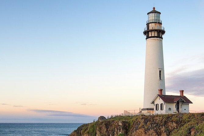
You will hear about an historic lighthouse guiding mariners since 1875, and the audio will explain what the lighthouse does now. Even if you do not get out immediately, the narration helps you read the coastline like a map. You stop seeing it as random cliff segments and start noticing the roles of light, shipping, and shoreline geography.
Then you pass by El Granada, known for its unique concentric-circular street layout. That detail is surprisingly memorable because it is the kind of thing you might never notice from the highway unless someone tells you to look for it.
The tour also references Pillar Point breakwater and points you toward the famous, gigantic-wave reputation of the area. If you are a waves person, you will appreciate the audio framing, because it gives context for why locals talk about the surf so seriously.
From there, you move through Half Moon Bay, where you get the story behind its historic beginnings described as quite interesting, plus the mix of history and natural splendor that shaped the place you see today.
What to watch for during this section:
- Scenic pull-offs along Highway 1 for quick beach viewing
- Town cues that help you identify where you are without constant re-checking of your map
- The transition from big open shoreline views to more built-up coastal towns
And yes, there will be plenty of moments where you can pull off for photos, because the tour mentions parking areas along the highway for scenic beaches.
Pescadero, Pescadero Marsh, and Año Nuevo: nature narration with real habitat meaning
This middle section shifts from town stories to the ecology of the coast.
You will hear about San Gregorio and San Gregorio State Beach, noted for being clean. Even without walking far, the narration helps you see that these are not just scenic stops, they are maintained coastal areas.
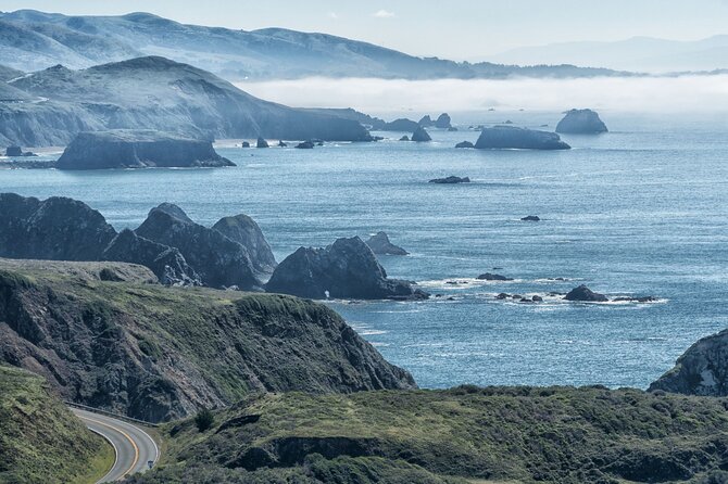
Then comes California Coastal National Monument, with a playful warning that you may be wondering where exactly it is. The audio will point you to where to look and how to connect the idea to what you can see from the road.
Next is Pescadero, with the Spanish meaning of Fishmonger and a background reaching back to the 19th century. The tour also paints the present-day blend: farming, tourism, and ranching. If you like coastal towns with real livelihoods, this is one of the stops that tends to feel more grounded.
Then you get the most important natural lesson in this segment: Pescadero Marsh as vital habitat for both migratory and native species. The audio describes it as part of why the area matters. This is where the self-paced format shines. You can slow down, pull over if you want, and use the narration to make your own observations instead of rushing through a check-list.
After that, you cruise along scenic Highway 1 again and hear about Año Nuevo State Park. The guide teases that the park’s main attraction is something specific, and it will tell you what it is. If you care about wildlife watching, listen closely here so you know what you are actually looking for.
Davenport, Shark Fin Cove, Santa Cruz Boardwalk, and the techy edge of the coast
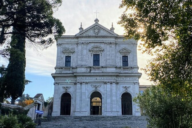
As the route progresses toward the Monterey side, you get a fun mix of nature spots and classic California attractions.
You will hear about Davenport, including an unusual line about what you could go to jail for. The point is tone: the audio keeps things lively while still grounding the stories in place.
Then there is Shark Fin Cove, flagged as special for photography and epic views. This is the kind of stop where I recommend you make your decision early: do you want a quick roadside stop for a view, or do you want to give it a few extra minutes for photos? Since this is mainly a driving audio tour, you will get better results if you treat photo stops as planned breaks instead of random impulses.
The tour then mentions a 65-acre area with historic buildings, including a Victorian home from 1897 and a water-powered machine shop. Even without stepping into every building, the narration helps you understand the theme: a late 19th century era told through physical structures.
Then it lands on Santa Cruz’s historic Boardwalk, operating since 1907, and featuring two roller coasters that are National Historic Landmarks. This is one of the few moments where the audio feels like it is pointing you toward a place you might actually want to park, grab a snack, and build a longer break into your day.
You also hear about northern Monterey Bay edge areas like Santa Cruz and the surrounding communities, including Aptos, described as made up of several charming villages.
Watsonville, the 7-mile tidal slough, salt marsh habitat, and the road’s geography payoff
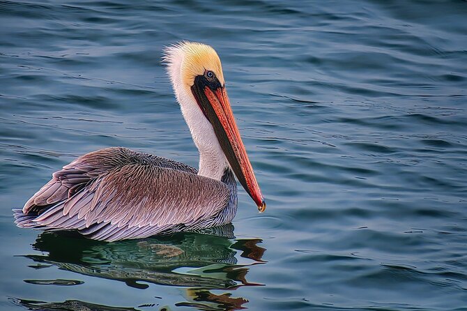
From Santa Cruz direction, the narration shifts toward the more “quiet science” side of the coast.
You pass through Watsonville, where the Ohlone nation of Indigenous Californians first inhabited the land. That detail gives weight to the coastline beyond recreation, and it sets up the next stops about waterways and habitat.
Then you move into a 7-mile-long tidal slough and estuary described as a jewel of California’s natural landscape. The audio explains why it matters, and it also frames the area as the largest untouched salt marsh on the California coast, with a description of what characterizes it.
In plain terms, this is one of the most valuable parts of the tour for people who think geography is more than a backdrop. You are learning how water shapes land, and how land shapes where animals can live.
The narration continues with a small town described as having a big reputation, and then a surprising reference to an underwater chasm compared in scale to the Grand Canyon. Even if you do not go looking for that exact underwater feature during your drive, it changes how you look at ocean cliffs and coastal edges. The ocean is not just surface waves, it is depth, structure, and shape.
Getting into Monterey: a final stretch of coast stories
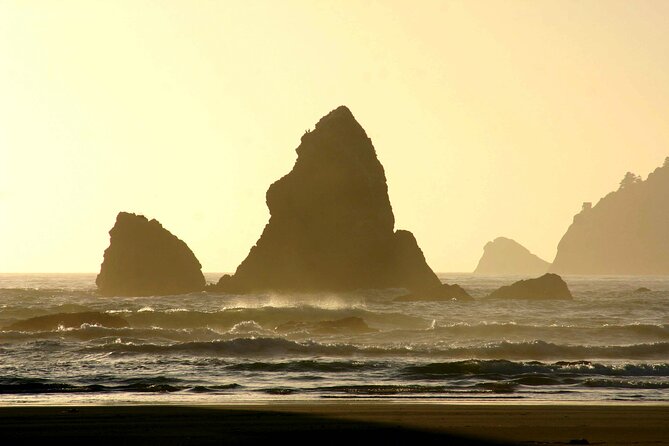
As you approach the city of Monterey, the audio wraps with a sense of Monterey as a jewel of California’s past. That closing theme matters because it gives you a reason to slow down near the end instead of treating the destination as just a landing spot.
Because this tour can start in San Francisco or Monterey, you can also choose the direction that fits your day. The experience is the same either way, so it becomes a practical planning tool, not a “right direction only” situation.
If you want the smoothest day:
- Start early enough that you can pause for photos without feeling time pressure.
- Do your heavier stops in the mid-to-late sections, where the audio highlights specific scenic areas and pull-offs.
- Keep your phone charged, and give yourself time to download the tour audio before you leave.
Price and logistics that actually affect your day
Let’s talk value, not just the number.
This is $11.99 per group, up to 15 people, and it covers a private experience for your group in your vehicle. You do not need a separate booking for each passenger. The tour is designed for the whole car.
Duration is about 2 to 3 hours, and you will see that most of the story is intended to run as you drive. If your group is already planning a road trip along Highway 1 or nearby coastal stretches, this can be a low-cost way to turn a drive into a guided, meaningful route.
The main logistical requirement is the initial setup. You need:
- a smartphone or tablet (smartphone/tablet is not included)
- good mobile or WiFi connection for the initial download
- volume controls so you can actually hear narration over road noise
Once downloaded, you get the best part: no signal required and no data used during the tour.
One more helpful detail: the tour is flexible with dates, and you keep it to use anytime through the Tripvia Tours app. That makes it easier to fit around weather or day-of decisions.
Who should book this audio driving tour
This works best if you:
- like road trips but do not want to spend all day on planning, ticket lines, or switching between apps
- enjoy stories tied to real places, like lighthouses since 1875, tide pools, and habitat areas such as marshlands
- travel in a small group that can share the per-group cost
It may not be ideal if you:
- want lots of frequent, built-in sightseeing stops where you can routinely park and hop out for long walks
- prefer a guide-led experience with set meeting points and time blocks for each attraction
If you fall somewhere in the middle, you can still make it work. Use the audio while driving, then treat the explicitly scenic moments like Shark Fin Cove, Moss Beach tide pool area, and the highway parking spots as your “real stops.”
How to make it feel like more than just listening
A common way to enjoy this kind of drive is to think in two layers: the narration layer and your photo or break layer.
Start with the audio download ready. Then, during the drive:
- Keep the volume just high enough that you catch names and key details
- Plan at least a couple of short pauses for views, especially where the tour mentions parking areas along the highway
- If you want to move faster early on, you can start driving and let the guide catch up for the first couple of segments before you settle into longer stops
If you are building a perfect day, do your bathroom break and snacks before you hit the heaviest stretch. Since the audio is built around continuous driving, you will enjoy it more if you do not interrupt it every few minutes.
Should you book this San Francisco to Monterey smartphone audio tour?
Yes, if you want a cost-friendly, self-paced way to learn the coast while you drive. The narration is the main attraction, and the structure is simple. The price per group and the private-by-vehicle setup make it a smart add-on for families and small friend groups.
I would skip it or choose a different style of tour if you want an itinerary full of guaranteed, frequent walk-up sightseeing stops. This one is best for people who are happy to listen while moving, then pause for a handful of key view and photo moments along Highway 1.
If your goal is to turn the SF to Monterey drive into a story you can actually remember, this is a strong pick.
FAQ
How much does the tour cost?
It costs $11.99 per group, up to 15 people.
How long does the smartphone audio driving tour take?
Plan on about 2 to 3 hours.
Where does the tour start and end?
You can start in Monterey (at Mark Thomas / Santa Catalina Monterey, CA 93940) or in San Francisco, and the tour ends at the corresponding San Francisco or Monterey point.
Can I start anywhere along the route?
Yes. The tour stops at either San Francisco or Monterey, and you can start anywhere along the route.
Do I need WiFi or mobile data during the tour?
No signal is required and no data is used during the tour. You only need a good mobile or WiFi connection for the initial download.
Is the tour available in English?
Yes, the tour is offered in English.
What do I need to bring?
You need your own smartphone or tablet. Transportation is also on you, meaning you use your own vehicle.
Is this a private tour?
Yes. It is private, and only your group participates.
How many bookings do I need for my car?
Only 1 tour booking is needed per vehicle.
What if my plans change?
You can cancel up to 24 hours in advance for a full refund.
More ways into Monterey, Carmel & 17-Mile Drive
 ★ 4.0Monterey, Carmel and 17-Mile Drive: Full Day Tour from SFFrom $1252,187 reviews
 ★ 4.4From San Francisco: Monterey and Carmel Day TourFrom $139476 reviews
 ★ 4.3Monterey and Carmel Day TourFrom $134110 reviews
 ★ 4.0Monterey, Carmel and Pacific Coast Explorer from San FranciscoFrom $13477 reviews
 ★ 4.4From LA: SF, Yosemite, Santa Barbara and Carmel 3-Day Tour72 reviews
 ★ 4.9From San Francisco: Carmel, Monterey & Big Sur Private TourFrom $92654 reviews
 ★ 5.0Monterey, Carmel, 17 Mile Dr, Big Sur & Mcway Falls Pvt TourFrom $89050 reviews
 ★ 4.517-Mile Drive, Monterey Peninsula &Carmel Max 12 Small Group TourFrom $11830 reviews
Try another angle on the same itinerary