
REVIEW · MUIR WOODS, MARIN & SAUSALITO TRIPS
Sausalito: Norcal Coastal Tour
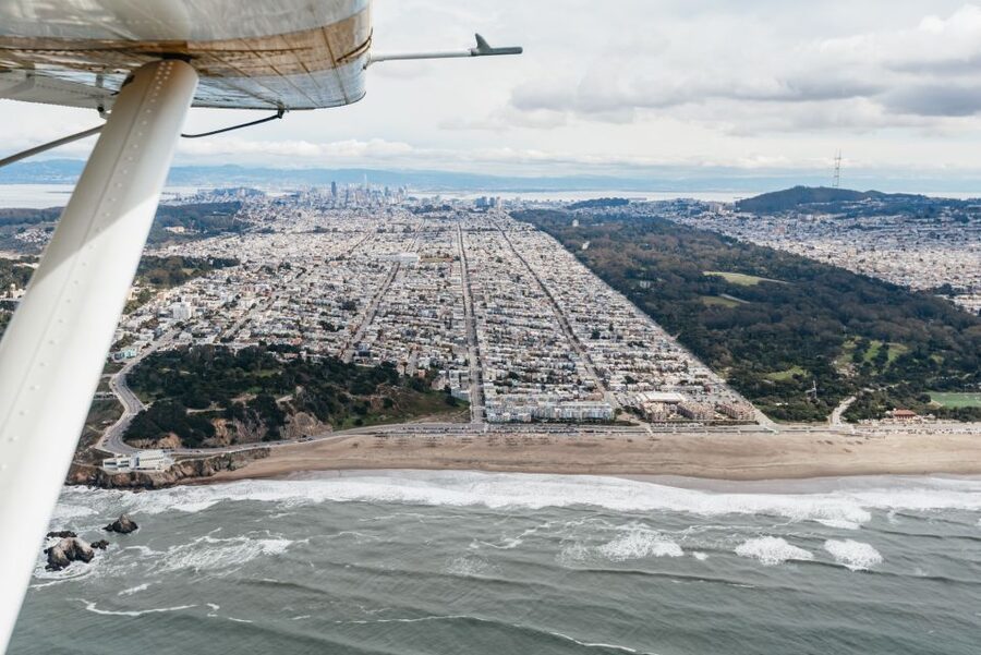
Flying above the Marin coast is pure magic, and this Sausalito seaplane tour turns coastal California into something you can really see and feel. I like two things most: the chance to view the Golden Gate Bridge from above, and the slow, scenic pass over Point Reyes National Seashore where you may spot wildlife. One watch-out, though: there’s a strict 260 lbs (124 kg) weight limit per passenger seat.
This is also the kind of flight where small details matter. You’re not just buying tickets for views. You’re paying for a pilot who guides your eyes, plus a water takeoff and landing that feels different from any land-based ride.
Key highlights you will actually notice

- Golden Gate Bridge from the air, with Marin and San Francisco both in frame
- Point Reyes National Seashore scanning for porpoise and whales
- Tomales Bay and the northern coastline stretches that look endless from above
- A fly-by over Crissy Field, downtown San Francisco, AT&T Park, and Alcatraz
- Angel Island pass and a smooth return landing at Richardson Bay
- Small group size (up to 6), so you are not fighting for window space
Redwood shade first, Sausalito waterfront after




Sausalito water takeoffs, and why this feels different
There’s something about a seaplane flight over the Bay that land tours can’t copy. The moment you lift off from the water, the coastline becomes a living map, with tide, shoreline shape, and distance all obvious in a way you just don’t get from the ground. In an hour, you cover a lot of ground, but it still feels personal, since the flight is built around clear sightlines to major landmarks.
I also love that this route is not only about the famous skyline. Yes, you’ll see San Francisco, but the flight spends enough time over the wild side of Northern California to make you feel like you left the city behind. The bones of the trip are: Golden Gate Bridge, Marin County, Point Reyes, then back over the Bay landmarks in time for a final glide back toward Sausalito.
The other thing that stands out is smoothness. Passengers consistently highlight how steady the flight and landing feel, which matters when you are flying over water and expecting an easy return. If you prefer experiences that are scenic first and stressful last, this setup makes sense.
Getting there: Mill Valley seaplane base and shuttle options
Your tour starts at Seaplane Adventures, with the meeting point listed at the seaplane base in Mill Valley: 242 Redwood Hwy, Mill Valley, CA 94941. Even though the flight itself begins from the water in Sausalito, your practical start is the Mill Valley operation base.
At checkout, you may choose between two approaches. You can meet at the seaplane base in Mill Valley, or you can book a roundtrip shuttle from Fisherman’s Wharf in San Francisco. If you take the shuttle, you still need to confirm pickup with the local partner at least 24 hours before your tour. Also, last-minute shuttle availability is not guaranteed, so if you are changing plans often, build in extra flexibility.
Group size is limited to 6 participants, so the “get organized fast” vibe is real. Show up on time, listen closely to the safety briefing, and you’ll likely get your window position without much fuss.
The hour overhead: how the route strings together
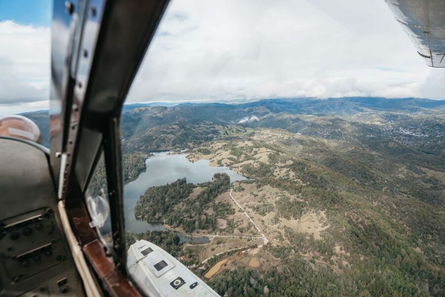
This is a deluxe 60 minute flight, with a guided experience led by the pilot. After takeoff from the sea base in Sausalito just across the Golden Gate Bridge, the flight heads out over Marin County. The arc of the route is designed so you repeatedly get a “big picture” view, then a closer, more focused angle on the coastline and landmarks.
On the way out, you travel over Tomales Bay, an area tied to stories of early explorers, and then continue toward Point Reyes National Seashore. When you reach the lighthouse area, you get a dramatic coastline moment, then the flight continues along the northern stretch of California near Highway 1 before turning back over the Golden Gate Bridge.
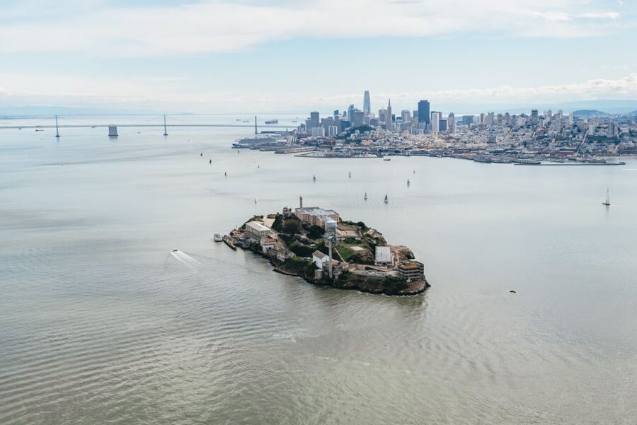
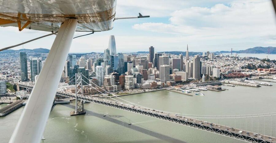
Then the story shifts to San Francisco. You fly over Crissy Field and downtown San Francisco, then pass above AT&T Park, home of the San Francisco Giants. The route also includes a fly-by near Alcatraz, and it finishes with a pass by Angel Island before a landing back in Sausalito’s Richardson Bay.
That structure is the real value. You get coastal wilderness and iconic city sights in one clean loop.
Marin County and Tomales Bay: start wide, then sharpen your view
The first real payoff happens early. Once you’re up and over the water, Marin County stops looking like “somewhere north of the city” and starts looking like a precise coastline with bays, curves, and open stretches that change hour to hour. The Tomales Bay portion is especially good for understanding how the Bay connects to the Pacific-facing edge.
You also get a sense of scale. From ground level, Point Reyes can feel like a single destination. From the air, you see the larger system: where bays shelter water and where the ocean opens things up. Even if you are not a wildlife watcher, this is a great segment because it sets expectations for what you’ll see near the seashore later.
Here’s the practical tip: keep your camera ready for the coastline transitions. The most dramatic views often happen in the moments where the flight crosses from one body of water into another, or where the shoreline straightens out. Those are the times when your “wow” angle lasts for longer than you expect.
Trade downtown blocks for redwoods and Pacific air



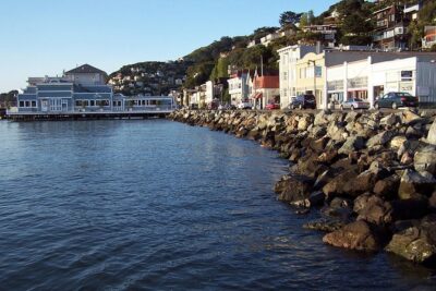

Point Reyes Lighthouse area: the coastline moment you came for
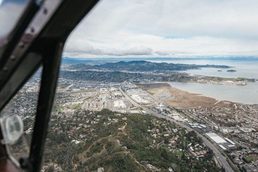
Point Reyes National Seashore is the star of the show on this flight. You’re not just skimming the edge. You’re rounding the scenic Point Reyes Lighthouse area and following the northern coastline above Highway 1. That means you get a view that feels like a slow panorama, not a quick fly-by.
This is also where the wildlife odds come into play. The flight route is described as looking for frolicking porpoise and whales along the way. You might spot them, you might not, but either way, the perspective helps you understand why this stretch of coast attracts marine life. From above, the water looks textured and channel-like in a way that can hint at what animals are feeding near.
A drawback to keep in mind: an air tour is still weather and routing dependent. If visibility is limited or the operator adjusts the route for flight safety, your exact sight lines over the seashore could shift. Still, the lighthouse and northern coast segment is a core part of the experience, so you are generally not signing up for a generic route that skips the good parts.
Above Highway 1 and toward the Golden Gate: the big-picture payback
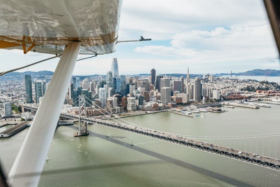
After Point Reyes, the flight keeps its momentum but stays scenic. Flying above the incredible Northern Californian coastline near Highway 1 gives you a high-level sense of how rugged California can look even when it is close to major cities. It’s one of those segments that makes you realize how quickly the region switches from urban density to open coast.
Then the route comes back toward the Golden Gate Bridge, and this is where the tour earns its nickname as a bridge-from-above experience. You don’t just see the bridge. You see it positioned in the Bay system, between shoreline shapes and water channels. It’s the difference between a postcard view and a working map view.
If you already know the Golden Gate from the ground, this segment is still worth it. Air altitude turns details like the bridge towers and the water’s curves into a single composition. You also get the quiet satisfaction of watching the flight line up the bridge angle before you fully understand it.
And yes, it is fast. It is only 60 minutes. But the route is paced so you are not constantly sprinting from landmark to landmark without time to actually look.
San Francisco from Crissy Field to AT&T Park and Alcatraz
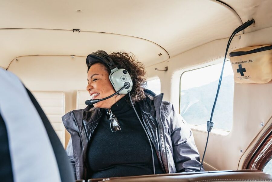
Once you’re over the city side, the flight becomes a tour of recognizable San Francisco shapes. You pass over Crissy Field first, which is a nice transition from the coastline feel into the urban Bayfront. Then you fly over downtown San Francisco and AT&T Park, home of the Major League Baseball San Francisco Giants.
This portion is great if you like seeing how neighborhoods and landmarks relate to water. From the air, downtown is not just a cluster of buildings. It’s a skyline sitting inside the geography of the Bay.
Next comes the island prison of Alcatraz. Even if you know Alcatraz from photos, the fly-by from above adds context through the surrounding water and the way boats and shoreline define the island’s presence. You’re not staring at a single building. You’re seeing the island as a distinct piece of terrain in a much larger environment.
A practical note for your photo planning: switch your camera mode as you change from city to coastline. The city portion tends to have more contrast and sharper edges, while the coastline portion often gives you more atmospheric blur. If you are quick to adjust, you’ll get more keepers.
Angel Island and the final Richardson Bay landing
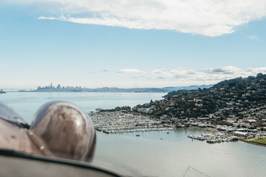
Before you land back in Sausalito, you get a pass by Angel Island, described as the immigrant gateway to the west. From the air, that idea clicks differently. You see it as a waypoint in a web of crossings, right there in the Bay where routes converge.
Then it’s time for the return landing in Sausalito’s Richardson Bay. This ending matters. A smooth landing is not just a comfort issue. It also lets you enjoy the final minutes instead of bracing for the last bump.
In passenger feedback, smooth flight and landing show up as a repeated theme, and that tracks with the overall design of the experience. The operator is running a seaplane route, so the goal is to make the whole thing feel controlled, not chaotic.
If you tend to get impatient on quick tours, you’ll probably like this ending. It closes the loop with a calm return to where you started, without the sense that you’re being rushed out immediately.
Price and value: what $399 buys you in real view time
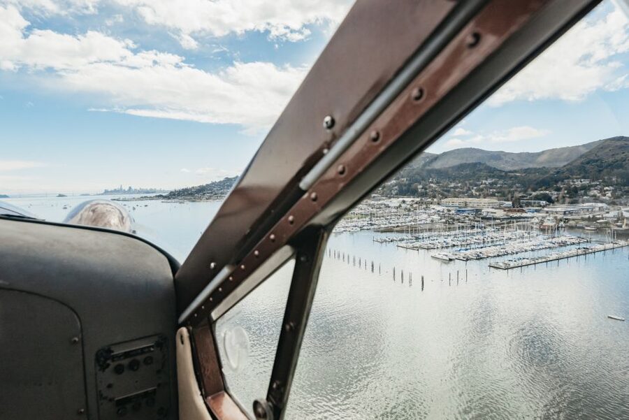
At $399 per person for a 1-hour flight, this is not a budget activity. But value here is about “what you can see for your time,” not about whether it feels cheap.
Here’s what you get for the price: a guided aerial route that combines Marin County coastlines, Point Reyes National Seashore, and major San Francisco landmarks, all in one session. A land tour would take multiple days to approximate this combination. Even if you try to piece together viewpoints, you’ll still miss the scale relationships you get from above, like how the Golden Gate Bridge sits within the Bay and how Point Reyes stretches out in a single continuous coastline arc.
The small group size also supports value. Limited to 6 participants, you are less likely to fight for a good view or feel packed in. And because the pilot guides the route, you are not just staring out the window trying to guess what you’re looking at.
Consider the trade-offs. The cancellation policy is listed as non-refundable. Weather can also cause flight cancellations or route alterations at the operator’s discretion. If you are the type who hates plan changes, plan carefully.
Still, if your priority is maximum perspective in a short window, this $399 price starts to look less like a splurge and more like a smart purchase of time.
Pilot narration, language options, and the small group feel
This tour is guided by a pilot who provides the narration. Passengers have specifically praised the way pilots explain what you are seeing and keep the experience smooth. That matters more than people expect, because aerial views can be confusing if you do not know what landmarks you are tracking.
Language options are English, French, and Dutch. French and Dutch guides are not guaranteed, and depend on the pilot’s availability. Even if you book with a different language in mind, English is part of the plan, and you’ll get the main story either way.
The small group size, up to 6 participants, helps the whole flow. It’s easier for the pilot to manage attention, safety instructions, and window turns. It also helps you feel less like you are on a production line.
One more consideration: there is a weight limit of no more than 260 lbs per seat. If you are near that limit, confirm before booking so you do not run into problems later.
Who should book, and who should skip it
This tour is a strong fit if you want iconic coastal and city views without a full day of driving. You’ll like it if you enjoy aerial perspectives, if you want a single hour that covers a lot of “best of NorCal” areas, and if you are okay with the reality that flight routes can adjust for weather and federal airspace mandates.
You should think twice if you need guaranteed multilingual guiding beyond English, since French and Dutch guides are not guaranteed. You should also think twice if you are sensitive to weather uncertainty, because flights may be canceled or rerouted for safety reasons.
And, most importantly, this is not suitable for people over 260 lbs (118 kg). That limit is firm.
If you are coming from a trip already full of museums and neighborhoods, this seaplane flight is a great palate cleanser. It swaps walking for looking, and it turns familiar landmarks into something fresh.
Should you book the Sausalito NorCal Coastal Tour?
If your goal is a high-impact coastal experience, I think this is an easy yes. The combo is strong: Golden Gate Bridge from above, Point Reyes National Seashore, and then San Francisco landmarks like Crissy Field, AT&T Park, and Alcatraz, plus Angel Island on the way back.
Book this if you:
- Want the most dramatic viewpoints in the fewest hours
- Prefer a small group setting
- Care about how the pilot guides your attention, not just where the plane flies
Skip or delay if you:
- Need zero schedule risk, since weather can cause route changes and cancellations
- Know you will not fit the 260 lbs per seat weight limit
- Are looking for a leisurely pace, since it is a tight 60 minutes
If you can handle a bit of real-world flight variability, this is one of those experiences that gives you a very specific kind of memory, the kind tied to angles, coastlines, and water you can’t quite replicate from land.
More Tour Reviews in San Francisco
- Muir Woods and Sausalito (Return by Bus or Ferry)★ 4.5 · 5,098 reviews
- Big Bus SF: Hop-on Hop-off Tour with 17 Stops and Sunset Option★ 4.0 · 4,539 reviews
- Napa and Sonoma Wine Country Full-Day Tour from San Francisco★ 4.5 · 4,455 reviews
- Small Group Yosemite and Giant Sequoias Day Trip from San Francisco★ 5.0 · 3,671 reviews
- San Francisco: Golden Gate Bay Cruise★ 4.7 · 3,644 reviews
- San Francisco: Hop-On Hop-Off Sightseeing Tour with 17 Stops★ 4.5 · 3,600 reviews
Redwoods Where the City Gives Way
- Muir Woods & Wine Tour: Redwoods & Tastings at 3 Wineries★ 4.5 · 278 reviews
- Small-Group Giant Redwoods and Russian River Wine Country Trip★ 5.0 · 205 reviews
- Small Group Redwoods, California Coast & Sausalito Day Trip from San Francisco★ 5.0 · 164 reviews
- San Francisco: Guided Coastal Redwoods & Wine Country Tour★ 4.5 · 89 reviews
- San Francisco: Armstrong Redwoods and Wine Tour with Tastings★ 4.0 · 80 reviews
- San Francisco: Redwood & Wine Country Tour with Lunch & Wine★ 4.4 · 69 reviews
Under the Redwoods, Back by the Bay
- Muir Woods and Sausalito (Return by Bus or Ferry)★ 4.5 · 5,098 reviews
- San Francisco Super Saver: Muir Woods & Wine Country w/ optional Gourmet Lunch★ 4.5 · 3,352 reviews
- San Francisco: Muir Woods and Sausalito Half-Day Trip★ 4.6 · 1,722 reviews
- One Day in San Francisco: Alcatraz, Muir Woods, and SF City Tour★ 5.0 · 1,445 reviews
- San Francisco: Muir Woods, Napa & Sonoma Valley Wine Tour★ 4.7 · 1,205 reviews
- Alcatraz Tour Plus Muir Woods and Sausalito Day Trip★ 4.0 · 1,194 reviews
Fresh arrivals for a San Francisco itinerary
- San Francisco: Tour De San Francisco (Electric Bike Tour)
★ 4.7 · 3 reviews - Private Exploration of the Birds of San Francisco
★ 5.0 · 4 reviews - Zion, Bryce, Antelope, Grand Canyon, Las Vegas 6-Day Tour from SF
★ 5.0 · 3 reviews - Private Tour of Yosemite a Two Day Exploration
★ 5.0 · 4 reviews - The Presidio: Main Post to the Golden Gate Bridge
★ 5.0 · 3 reviews - Alcatraz Island Tour with San Francisco Bay Tour
★ 3.5 · 4 reviews
More ways into Muir Woods, Marin & Sausalito Trips
 ★ 4.5Muir Woods and Sausalito (Return by Bus or Ferry)From $915,098 reviews
 ★ 4.5San Francisco Super Saver: Muir Woods & Wine Country w/ optional Gourmet LunchFrom $1793,352 reviews
 ★ 4.6Muir Woods and Sausalito Half-Day TripFrom $951,722 reviews
 ★ 5.0One Day in San Francisco: Alcatraz, Muir Woods, and SF City TourFrom $1291,445 reviews
 ★ 4.7Muir Woods, Napa & Sonoma Valley Wine TourFrom $1661,205 reviews
 ★ 4.0Alcatraz Tour Plus Muir Woods and Sausalito Day TripFrom $1591,194 reviews
 ★ 4.5Alcatraz with Muir Woods and Sausalito TourFrom $1591,131 reviews
 ★ 5.0Golden Gate Bridge Muir Woods Sausalito with Optional AlcatrazFrom $1191,106 reviews
Try another angle on the same itinerary