
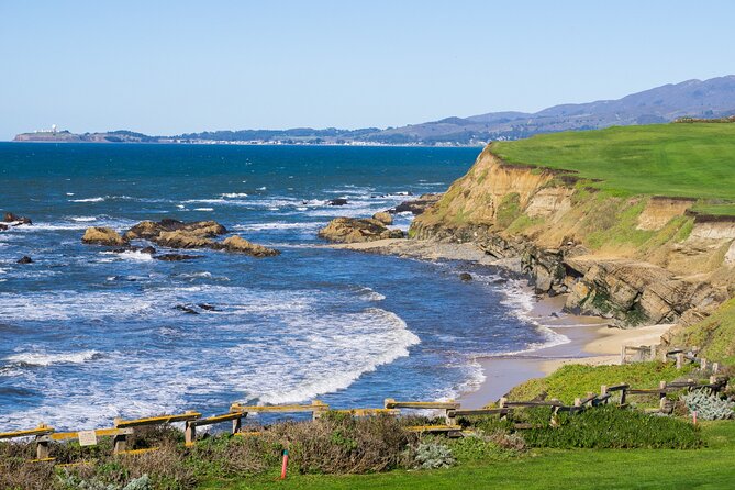
REVIEW · MONTEREY, CARMEL & 17-MILE DRIVE
Highway 1 Pacific Coast Highway Self-Guided Driving Tour Bundle
Highway 1 feels long, until it feels guided. This self-led audio drive strings together classic ocean stops with offline GPS cues, so your phone becomes your narrator. I like that the stories play hands-free based on where you are, which makes the drive easier to manage.
The tour’s value is strong, because the ticket is priced per group, up to 4, and it stays valid for a full year. That means you can repeat parts of Highway 1 later without buying again. One possible drawback to plan around: the guidance is built for audio cues, not turn-by-turn directions, so it helps to keep an eye on your screen.
If you want a road trip where you do not miss the iconic sights, and you are happy to drive and listen, this can be a smart buy.
Key Things I’d Focus On Before You Hit Start
- Offline GPS and location-based audio that works after you download on strong signal
- One-year validity, great for repeat drives or lingering in one area
- A packed PCH route from Pacifica past lighthouses, beaches, redwoods, and seals to Santa Monica
- Stop timing that keeps you moving, even if you pause for photos and snacks
- Some stops may need extra entry fees, since not everything is marked as included
- Navigation is light, so you will want your phone mounted and visible
Southbound choices for Carmel, Monterey and the coast
Price and What You Really Get for $29.99
At $29.99 per group (up to 4 people), this is priced like a car purchase, not an individual tour ticket. For a drive that can stretch 10 to 11 hours with stops, that matters. If you are traveling with a couple friends or family members, the per-person cost drops quickly compared with doing everything via separate paid tours.
Another value angle is the one-year validity. This is not just a one-and-done pass. You can use it during an extended trip, or come back to the Central Coast and Big Sur later when you have more time for the hike you skipped.
The only caution on price is what is not included: there are no attraction passes, entry tickets, or reservations built in. In other words, you pay for the audio guidance and route help, then decide case-by-case what you want to enter, park near, or hike.
Offline Audio, GPS Cues, and Timing on Pacific Coast Highway
The heart of the experience is the smartphone audio guide in the Action’s Tour Guide App. After you book, you get a password by email and text, then you download the app’s tour package. The key detail is that you must download while you are on strong Wi-Fi or cellular. After that, the guide works offline.
Once you are on the route, the audio stories play automatically based on your location. You can start at the designated starting point, pause when you want, and continue later. This “drive and listen” style works especially well on Highway 1, where the hard part is choosing what to look at while staying safe on a winding road.
Timing can affect audio sync. One support suggestion from the operator side is to follow the suggested speed, and if you want truly hands-free listening, connect your phone to your car stereo. If you constantly slow to an abrupt stop and restart, you can expect the audio timing to feel less tidy.
How to Start Correctly and Avoid Getting Off-Route
This tour is self-guided, which means no one meets you at the start. You go to the starting point, then open the Action’s Tour Guide App once onsite. If multiple versions exist, you should pick the one that matches your planned starting point and direction.
I recommend you do two things before you drive:
1) Mount your phone where you can glance quickly without taking your eyes far off the road.
2) Start the tour at the exact starting location so the GPS cues line up.
A common problem pattern with audio tours like this is that directions can feel light. In plain terms, the app is giving you story prompts, not a detailed turn-by-turn plan. If you get nervous about route accuracy, keep the screen visible, and use your GPS map as backup.
From San Francisco to Pacifica: Getting Oriented on Day One
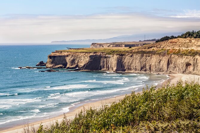
The tour start is at PG6H+8F San Francisco Lakeshore, San Francisco, CA. The guide runs south all the way to the Santa Monica Pier. The “10 to 11 hours” time is best understood as driving plus photo and lookout stops, not nonstop momentum.
Your first story stop is Pacifica. You’ll learn how Gaspar de Portolá helped put this stretch on the map, plus an unusual angle on how Pacifica got its name.
A short drive later comes Pedro Point, a rocky ocean point with phenomenal views. There used to be a road to it, but now access is via footpath and only at low tide. That is the kind of detail that turns a generic pull-off into a real moment, as long as you plan your stop around timing.
Put a local voice beside the landmarks

Pedro Point, Devil’s Slide, Whale Spots, and Montara
Next up is Devil’s Slide Trail. This spot has a WWII bunker connection, built to watch for a possible Japanese invasion. The story shifts hard from military surveillance to today’s scene where local youths and graffiti artists hang out.
Then Gray Whale Cove State Beach. The guide points out whale-watching potential, especially in December and January when gray whales migrate south and can be close enough to see with the naked eye.
Montara is a quieter tonal shift. It ties to an old lighthouse, and the guide paints the charm of a rustic town where older buildings still stand. If you like “small town with a purpose,” this is one of those stops.
After that, there’s a major surfing-focus lookout where swells can reach up to 60 feet in peak season. If you are not surfing, it is still worth stopping for the sheer scale, just do not expect a relaxed stroll. High surf also means extra caution around edges and pull-offs.
Half Moon Bay is next, and it comes with a dark twist. This area was once known as the most corrupt county in California due to mob activity, which is not the kind of story you expect when you are just seeing a pretty bay.
Bean Hollow State Beach follows, named for an oddly shaped coastline that some people say resembles a bean. It’s a humble break with scenery that works well if you want 10 minutes of ocean air without a big mission.
Pigeon Point Lighthouse is a real standout photo stop. The lighthouse is 115 feet tall, described as the tallest on the West Coast and also one of the oldest. This is the kind of place where you stop, breathe, and take the photo you came for.
Redwood Passing Stops and the Elephant Seal Window
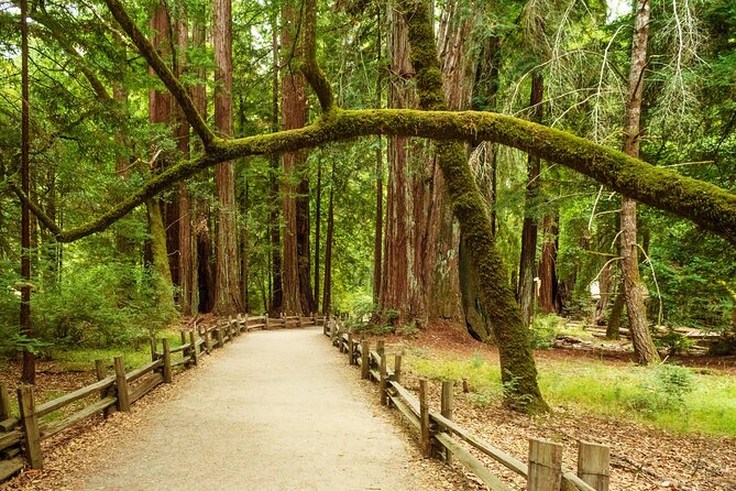
After Pigeon Point, you will pass redwood groves as you drive. You do not directly enter everything, but the guide highlights what makes the trees awe-inspiring and worth slowing down for even without a long walk.
Big Basin Redwoods State Park is called out next, with tall old-growth trees and the possibility of wildlife sightings, especially if you are traveling in the morning. The guide also points you toward a state reserve where elephant seals are a big feature. The best months are between December and April, when it is breeding season.
This is where the audio guide earns its keep. It tells you when to expect the wildlife, so you are not guessing whether a stop is worth your time. If your trip lines up with that window, this section can feel like a bonus safari, right along PCH.
Davenport to Santa Cruz: Cracks, Pocket Beaches, and Classic California Town Energy
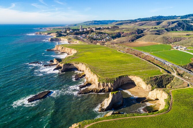
Davenport is one of the smaller towns on the route, with just over 400 people. It is well known for pristine beaches. The tour also mentions the Davenport Crack, where water has carved a tunnel through a cliff, creating the illusion that the land split in two.
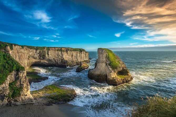
Next you get a cove with a name that sounds scary, because it is tied to a distinctive rock formation that looks like a shark’s fin. You are not meant to worry about actual sharks here. The point is the visual shape and the chance to watch water movement.
Then there are pocket beaches, described as small, secluded, and reached via scrabbling. The reward is fewer crowds. If your idea of a perfect beach stop includes privacy more than convenience, this part fits your vibe.
Santa Cruz is the next major turn. The guide calls it a must-see town, founded in 1791, known for architecture, food, and quirky shops. If you want the classic California boardwalk energy, Santa Cruz Wharf is the hotspot, packed with seafood restaurants and the amusement park with a fully functional wooden roller coaster.
The Mystery Spot is nearby. It has guided demonstrations that appear to defy gravity, and the walk is short but steep, with effects inside a wooden building.
From there you also get a larger beach with ample parking, ocean views, towering bluffs, and a pet-friendly setup. Sunset State Beach is flagged as a top Central Coast sunset spot, but the guide makes one practical point: plan ahead, because late afternoon draws crowds.
Elkhorn Slough Reserve follows as a serious wildlife-and-nature intermission. It is a wetland where saltwater meets freshwater, and it is linked to over 700 species of terrestrial and marine animals. Even if you only pass by, it is the kind of location where your odds of spotting something improve when you slow down and look.
The guide then highlights coastal views tied to sardines, explaining how the bay’s sardine population was once plentiful and what changed. This is a great example of why audio works here: you are driving through a place, and the guide gives you a human-sized explanation for why the coastline looks the way it does.
Monterey closes the Santa Cruz stretch. The guide says Monterey was once centered on the sardine-packing industry, and today Cannery Row is a popular strip of converted factories with gift shops, seafood restaurants, and bars. It also points you to the Monterey Bay Aquarium, with thousands of marine animals and interactive exhibits.
Big Sur, Carmel, and the Photo Stops You Will Not Forget
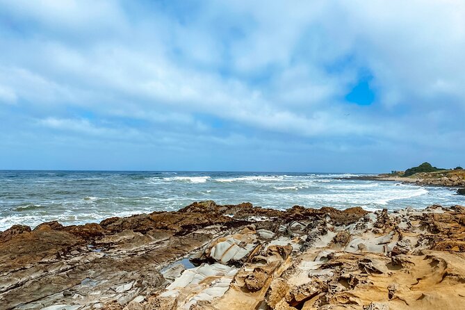
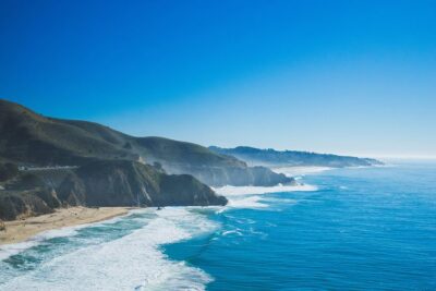
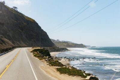
Big Sur is described as the most iconic section of PCH, with dramatic bluffs rising hundreds of feet above crashing waves, plus lush greenery and rocky hiking trails. This is not a place where you can rush. Even if you stay in the car, the pull-offs and the cliff views ask you to slow down.
The guide also includes the 17-mile detour through Pebble Beach and Pacific Grove. It’s framed as a scenic drive with lavish estates on one side and ocean views on the other. Even if you do not stop for long, you are getting a different feel than the main highway.
Carmel-by-the-Sea comes next, presented as picture-perfect, with fairytale cottages and eccentric residents. It also mentions an unusually high number of art galleries, which is why this stop works well for people who like to browse on foot.
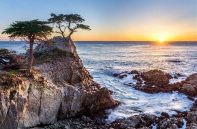
Carmel’s cypress grove beach is a practical add-on. It is a place locals come for surfing, walking dogs, and watching the sunset. Right after that, the guide points out a reserve with a mix of marine and terrestrial animals and calls it a good spot for scuba diving if you want to get off the shore-based view.
Garrapata State Park is another meaningful stop, but it is listed as not included for tickets. The tour describes trails that lead to the coast for ocean views, plus trails through valleys of lilies and even redwood groves. If you plan on hiking, budget extra time because this is the kind of place where the walk can turn into your whole afternoon.
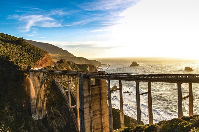
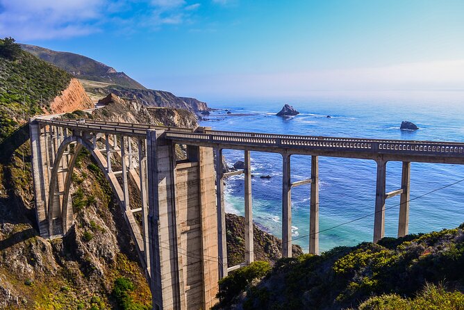
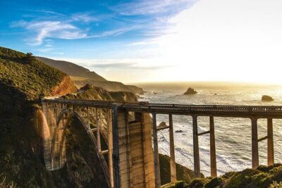
Bixby Creek Bridge is next, and it is one of the most photographed bridges in California. The guide ties the clean concrete arch to the ocean and green bluffs, which tells you why this photo looks so good even without filters.
The route then brings Point Sur into the story. The guide describes a mountainous island that used to be a nightmare for ships traveling at night, and credits the Point Sur Lighthouse with helping change that. It also notes that it is on the National Register of Historic Places.
A key context note appears here too: the guide says that former land owners forbade development along this stretch, resulting in unusually untouched wilderness. That is a big part of why Big Sur feels remote even when you are just driving by.
There is also a stop about a bridge replacement built after a major landslide in 2017. The guide frames it as brand new, replacing an earlier structure that cracked. If you are sensitive to how infrastructure changes the feel of a place, this is one to notice.
Pfeiffer Beach is a must if you like geology. It is described as off the beaten path with a detour down a narrow road. It is famous for purple sand, explained as coming from manganese garnet washed down from nearby bluffs.
The guide also includes a dirt lot viewpoint with one of the very best Big Sur views, then Seal Beach Overlook for California marine mammals, with a good chance of seeing seals lounging on rocks.
Partington Cove is next. It is sheltered and secluded, with a rumor about moonshiners during Prohibition. It is listed as not included for admission, so treat it as a potential fee or parking situation depending on conditions.
Then comes a waterfall story. The guide says it once cascaded directly into the Pacific, until mudslides changed the landscape permanently. It is still described as impressive to see in person.
Big Creek Bridge follows as another architectural marvel at 589 feet long. The guide says there are turnouts at each end so you can pull over and photograph safely.
After that, there is a vista point stop for more photos, then Limekiln State Park. The guide explains that it gets its name from lime production, and that four historic lime kilns from the 19th century remain and are among the park’s popular attractions.
Pitkins Curve Bridge comes next, and this one is about problem solving. It uses a protective shed and a bridge designed to safeguard the highway from rockslides. The guide notes that the story behind how designers came up with the structure is even more interesting than the odd look.
Then you get a jade cove, previously tied to a major prospecting rush. Most gems are already gone, but visitors can still find small pieces of jade.
Right after, the guide points out an old-growth redwood grove and mentions that some trees can reach up to 350 feet tall. Ragged Point follows with bluffs soaring up to 400 feet, minimal development, and scenic vistas.
There is also a rustic inn stop popular for quick bites, even if you are not a guest. The route then mentions a lighthouse that looks like someone cut off the top section, and notes the reason as you pass.
Finally in this Big Sur stretch is Elephant Seal Vista Point. The guide says it is one of the best places to see elephant seals, with a good chance of seeing many at once lounging on rocks. It also says the walkway is fully accessible.
Down the Coast: Moonstone Boardwalk, Trash Art, Tiny Towns, and Big Rocks
Moonstone Beach Drive is a scenic detour with a boardwalk running along the beach, making it easy to stretch your legs before continuing. That simple “walkable break” is a big quality-of-life detail on long drives.
Next is Nitt Witt Ridge, described as one of the strangest landmarks on the route. The guide explains that the house was built by reclusive artist Arthur Beal and made almost entirely from trash. If you like roadside oddities, this is your stop.
Harmony is one of the smallest towns on the route, with a population given as 18. It is a quick culture pause, more mood than attraction.
Cayucos is next, described as unincorporated with an old-timey Wild West vibe, founded in 1867. Expect a town feel with saloons and antique shops.
Morro Bay adds a big geology feature: Morro Rock, a volcanic plug rising 600 feet out of the water. The guide notes peregrine falcons nesting there, so this is a “look up, then look again” moment.
San Luis Obispo is the next larger town: lush greenery, flowers, and lots happening, with a laid-back feel locals call SLO Cal. Bubblegum Alley follows, with both walls covered in bubble gum left by countless visitors. The guide invites you to add your own if you have a stick.
Then there is a shift to land use history: chromium and mercury mines once operated here, and today the area has over 8 miles of trails for hiking and mountain biking.
Avila Beach is next, and it includes a dark story about an oil company obliterating the town and then rebuilding it. The name is still pretty, but the guide adds the context.
Dinosaur Caves Park is another surprise stop. No dinosaurs and no caves, but it is still a lovely picnic area, with the origin of its unusual name explained on site.
Pismo Beach gets you mission-era connections. The guide says the shoreline was one of the first landing places of European missionaries journeying to the new world.
Then comes monarch butterfly season. Between October and February, around 25,000 monarch butterflies shelter in eucalyptus trees. If you are in those months, this is a straight-up must-stop based on the guide’s schedule.
Monarch Season, Guadalupe Dunes, Lompoc Murals, and Santa Barbara Charm
Guadalupe is a small, quiet break from the road. Then you head toward dunes described as the tallest on the entire West Coast, with heights up to 500 feet. The guide frames the payoff as an unbelievable panorama once you are up top.
Lompoc enters as a color-and-culture segment. The guide says the town grows tens of thousands of flowers each year, and murals around town pay homage to that industry, with 40 murals in total. It then highlights the Lompoc Wine Ghetto as a cluster of world-class wineries and tasting rooms.
There’s an optional detour to Jalama Beach. The guide positions it as quieter and an alternative to more crowded shores. If you want less foot traffic, this is the stop that usually helps your sanity.
The guide then suggests a vista point where the California scene changes dramatically as you continue south. That is the tour’s selling point in motion: you do not see the same thing twice.
Refugio State Beach is called out as a quintessential California beach with white sand, palm trees, plenty of sunlight, and shockingly blue water. It is another good pick if you want an easy stop without a huge hike commitment.
The monarch theme continues with another butterfly grove like the Monarch Butterfly Grove. This one is more complicated because eucalyptus trees are struggling and the guide says fewer butterflies are showing than normal. Still, it calls it a must-see if you are there between November and February.
Santa Barbara then becomes the “big pretty town” moment. The guide describes it as one of California’s prettiest towns, originally a Spanish mission town, now a hub for artists, top tier restaurants, and idyllic beaches.
Thousand Steps Beach gets its name clarification: there are actually 218 steps down to the beach. Carpinteria State Beach follows with a practical wildlife hint, harbor seals as a possible sighting.
Rincon Beach is a major surfing destination and hosts Rincon Classic. The guide mentions surfing legends like Tom Curren and Bobby Martinez. Even if you do not surf, watching events and energy at a famous break can be part of the fun.
Faria Beach is another surfing-oriented stop, especially around Las Pitas Point, and the guide notes limited sand space, which can mean more privacy but less room for casual beach time.
Ventura, Malibu, Getty Villa, and the Santa Monica Pier Finish
Ventura, also called San Buenaventura, is next. The guide calls it a fabulous SoCal city with shoreline, character, and plenty of restaurants and boutiques along its seaside boardwalk. It also drops famous name references like Johnny Cash and John Lennon, which helps you place the city on the wider California map.
Point Mugu Rock is then described as ancient volcanic rock that once posed major problems for engineers building PCH. Now it is framed as a pull-over photo stop with picture-perfect coastline views.
Sycamore Cove Beach is a favorite among campers, and it includes picnic tables and grills for public use, making it a smart spot for a real break if you are still hungry after earlier snacks.
El Matador State Beach is described for weird and fascinating rock formations. The guide says sunset is the absolute best time here, which is a useful reminder because this kind of beach looks good even at midday, but it shines later.
Point Dume is one of the LA area highlights the guide includes. It explains that Zuma Beach and Point Dume are favorite beach getaways for Los Angeles residents, and it adds an iconic filming connection. It says Charlton Heston’s character sees the destroyed Statue of Liberty shot in Planet of the Apes from here.
Malibu follows as the epitome of a SoCal beach town, with laid back vibes and excellent surfing opportunities. The guide also references celebrity home owners like Tom Hanks, Matthew McConaughey, Ellen DeGeneres, and Bob Dylan.
Then the tour points out Santa Monica as the finish line. You end right by the Santa Monica Pier, described as loaded with food and fun, plus the endless beach that makes the LA coastal vibe feel effortless.
The guide also includes a route context note: State Route 1 runs along most of California’s Pacific coastline, with a total just over 656 miles. It also mentions the Getty Villa at the eastern end of the Malibu coast in Pacific Palisades, which is a nice cultural detour if your day has extra energy.
Finally, the tour includes Hearst Castle in San Simeon, described as a National Historic Landmark and California Historical Landmark conceived by William Randolph Hearst and architect Julia Morgan, built between 1919 and 1947.
Who This Self-Guided Audio Drive Is Best For
This is best for you if you like independent travel with structure. The stories help you make sense of what you are seeing, and the offline GPS reduces the mental load of constantly searching.
I also think it works well for first-time PCH drivers. When you have an audio plan, it is easier not to miss the lighthouse photos, seal viewing windows, and the Big Sur stop points that people talk about for a reason.
If you need heavy turn-by-turn navigation, this may feel thin. The strongest criticism pattern around audio-only driving guides is that you can get off route if you focus on the road and ignore your screen. If you are the kind of driver who likes clear written directions or constant visual cues, be prepared to actively use your phone display.
Should You Book This Highway 1 Audio Tour?
Book it if you want value, flexibility, and a guided feeling without booking a seat on a bus. At $29.99 per group with one-year use, it is easy to justify if you are driving Highway 1 anyway and you want context for the stops you already planned to see.
Skip it or choose something else if you are hoping for deep directions or guaranteed trouble-free startup. The tour depends on correct download and starting location, and audio tours can react poorly if your phone setup or GPS behavior is unstable. If you do your download on strong signal, start at the right point, and keep your phone accessible, you will set yourself up for the smoother kind of road trip where you actually enjoy the drive.
FAQ
How much does the Highway 1 audio tour cost?
It costs $29.99 per group, up to 4 people.
How long does the drive take?
The duration is listed as about 10 to 11 hours. The guide also notes that the 555-mile stretch can cover essentials in about 5 to 7 hours of driving, depending on stops.
Does the tour work offline?
Yes. Offline maps are included, and the tour is designed to work without cellular or Wi-Fi after you download it.
Do I need entry tickets for each stop?
No. Attraction passes, entry tickets, or reservations are not included. Some stops are marked free, while others are marked as not included.
What app do I need to use?
You download the separate Action’s Tour Guide App onto your phone and then enter the password sent after booking.
Where does the tour start and end?
It starts at PG6H+8F San Francisco Lakeshore, San Francisco, CA and ends at Santa Monica Pier (108 Santa Monica Pier, Santa Monica, CA 90401).
Is this a guided tour with staff meeting me?
No. It is self-guided. No one meets you at the start.
How do I start the stories once I arrive?
Open the Action’s Tour Guide App onsite. Launch the tour version that matches your planned starting point and direction, then enter the first story’s point so the audio begins automatically.
What if my audio or download does not work?
The instructions say you must download while you have strong Wi-Fi or cellular, then it works offline. If you face audio issues, you should contact support.
Can I get a refund if I cancel?
Yes. Free cancellation is available up to 24 hours in advance for a full refund.
More Tours in San Francisco
- Big Bus SF: Hop-on Hop-off Tour with 17 Stops and Sunset Option★ 4.0 · 4,539 reviews
- Napa and Sonoma Wine Country Full-Day Tour from San Francisco★ 4.5 · 4,455 reviews
- San Francisco: Hop-On Hop-Off Sightseeing Tour with 17 Stops★ 4.5 · 3,600 reviews
- Yosemite Highlights & Giant Sequoias Day Tour from San Francisco★ 4.5 · 3,455 reviews
- San Francisco Love Tour★ 5.0 · 2,830 reviews
- San Francisco: Alcatraz Island & 48-Hour Hop-On Hop-Off Tour★ 4.6 · 2,245 reviews
More Tour Reviews in San Francisco
- Muir Woods and Sausalito (Return by Bus or Ferry)★ 4.5 · 5,098 reviews
- Big Bus SF: Hop-on Hop-off Tour with 17 Stops and Sunset Option★ 4.0 · 4,539 reviews
- Napa and Sonoma Wine Country Full-Day Tour from San Francisco★ 4.5 · 4,455 reviews
- Small Group Yosemite and Giant Sequoias Day Trip from San Francisco★ 5.0 · 3,671 reviews
- San Francisco: Golden Gate Bay Cruise★ 4.7 · 3,644 reviews
- San Francisco: Hop-On Hop-Off Sightseeing Tour with 17 Stops★ 4.5 · 3,600 reviews
Carmel and Monterey Down Highway 1
- Monterey, Carmel and 17-Mile Drive: Full Day Tour from SF★ 4.0 · 2,187 reviews
- San Francisco: Monterey and Carmel Day Tour★ 4.3 · 110 reviews
- Monterey, Carmel and Pacific Coast Explorer from San Francisco★ 4.0 · 77 reviews
- From LA: SF, Yosemite, Santa Barbara and Carmel 3-Day Tour★ 4.4 · 72 reviews
- From San Francisco: Carmel, Monterey & Big Sur Private Tour★ 4.9 · 54 reviews
- Monterey, Carmel, 17 Mile Dr, Big Sur & Mcway Falls Pvt Tour★ 5.0 · 50 reviews
Fresh arrivals for a San Francisco itinerary
- San Francisco: Tour De San Francisco (Electric Bike Tour)
★ 4.7 · 3 reviews - Private Exploration of the Birds of San Francisco
★ 5.0 · 4 reviews - Zion, Bryce, Antelope, Grand Canyon, Las Vegas 6-Day Tour from SF
★ 5.0 · 3 reviews - Private Tour of Yosemite a Two Day Exploration
★ 5.0 · 4 reviews - The Presidio: Main Post to the Golden Gate Bridge
★ 5.0 · 3 reviews - Alcatraz Island Tour with San Francisco Bay Tour
★ 3.5 · 4 reviews
More ways into Monterey, Carmel & 17-Mile Drive
 ★ 4.0Monterey, Carmel and 17-Mile Drive: Full Day Tour from SFFrom $1252,187 reviews
 ★ 4.4From San Francisco: Monterey and Carmel Day TourFrom $139476 reviews
 ★ 4.3Monterey and Carmel Day TourFrom $134110 reviews
 ★ 4.0Monterey, Carmel and Pacific Coast Explorer from San FranciscoFrom $13477 reviews
 ★ 4.4From LA: SF, Yosemite, Santa Barbara and Carmel 3-Day Tour72 reviews
 ★ 4.9From San Francisco: Carmel, Monterey & Big Sur Private TourFrom $92654 reviews
 ★ 5.0Monterey, Carmel, 17 Mile Dr, Big Sur & Mcway Falls Pvt TourFrom $89050 reviews
 ★ 4.517-Mile Drive, Monterey Peninsula &Carmel Max 12 Small Group TourFrom $11830 reviews
Try another angle on the same itinerary